
Yucca Valley ZIP Code Coverage
The postal geography around Yucca Valley has one main delivery ZIP, a special-use companion, and nearby ZIP identities that do not automatically mean Town jurisdiction. The five rows below keep postal usage, post office service, and boundary cautions together. A ZIP code routes mail. It does not by itself establish a parcel's location, an owner's address, or the agency responsible for a record.
| ZIP Code | Areas Covered | Post Office | Notes |
|---|---|---|---|
| 92284 | Yucca Valley and postal territory beyond the incorporated line, including some Yucca Mesa and nearby desert addresses | Yucca Valley Post Office, 57280 Yucca Trail, Yucca Valley, CA 92284-7915 | Primary delivery ZIP; postal city does not prove Town jurisdiction |
| 92286 | Yucca Valley-associated postal, PO-box, and special routing | Served through the Yucca Valley postal operation; confirm box assignment with USPS | Do not treat as a second ordinary neighborhood polygon |
| 92252 | Joshua Tree; Census ZCTA partly overlaps Yucca Valley Town | Joshua Tree Post Office, 61416 29 Palms Highway | ZCTA overlap is statistical, not a USPS or Town boundary |
| 92285 | Landers | Landers Post Office, 890 Landers Lane, Landers, CA 92285-9998 | Nearby unincorporated community, not automatically a Town ZIP |
| 92268 | Pioneertown | Pioneertown Post Office, 53441 Mane Street | Nearby community with a separate postal identity |
92284 is the primary mailing ZIP associated with Yucca Valley. USPS historical sorting schemes group 92284 through 92286 under the Yucca Valley postal destination, while 92285 is associated with Landers. Every actual street address should be checked in the USPS tool because a table can explain a pattern but cannot validate a new or changed delivery point.
The San Bernardino County office directory helps show why postal and records geography are separate. County locations may serve the Morongo Basin while a Town department, court district, or assessor map follows another boundary.
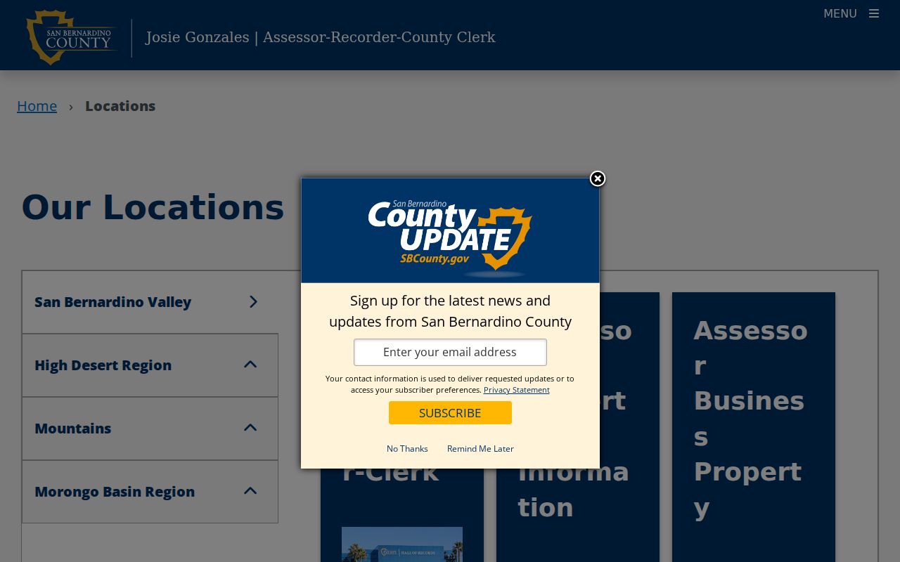
Use the county location list to identify the custodian after the postal check, not as a substitute for an address-level ZIP result.
Yucca Valley 92284 Postal Territory
92284 carries the ordinary street-delivery identity most people mean by a Yucca Valley mailing address. It also reaches past the incorporated line. Addresses described locally as Yucca Mesa or nearby desert sections can share the postal city without falling under Town planning, permit, or code authority. The commercial and postal spine along Highway 62 and 29 Palms Highway does not turn the ZIP into a neighborhood roll.
The Yucca Valley Post Office is listed at 57280 Yucca Trail, Yucca Valley, California 92284-7915, with phone 760-365-0725. The location page lists retail hours Monday through Friday from 9 a.m. to 5 p.m., Saturday from 10 a.m. to 1 p.m., 24-hour PO Box access, and 11 a.m. box delivery Monday through Saturday. Hours can change, so check the current Yucca Valley Post Office listing before visiting.
The postal facility image is useful for recognizing the official destination behind a 92284 label.
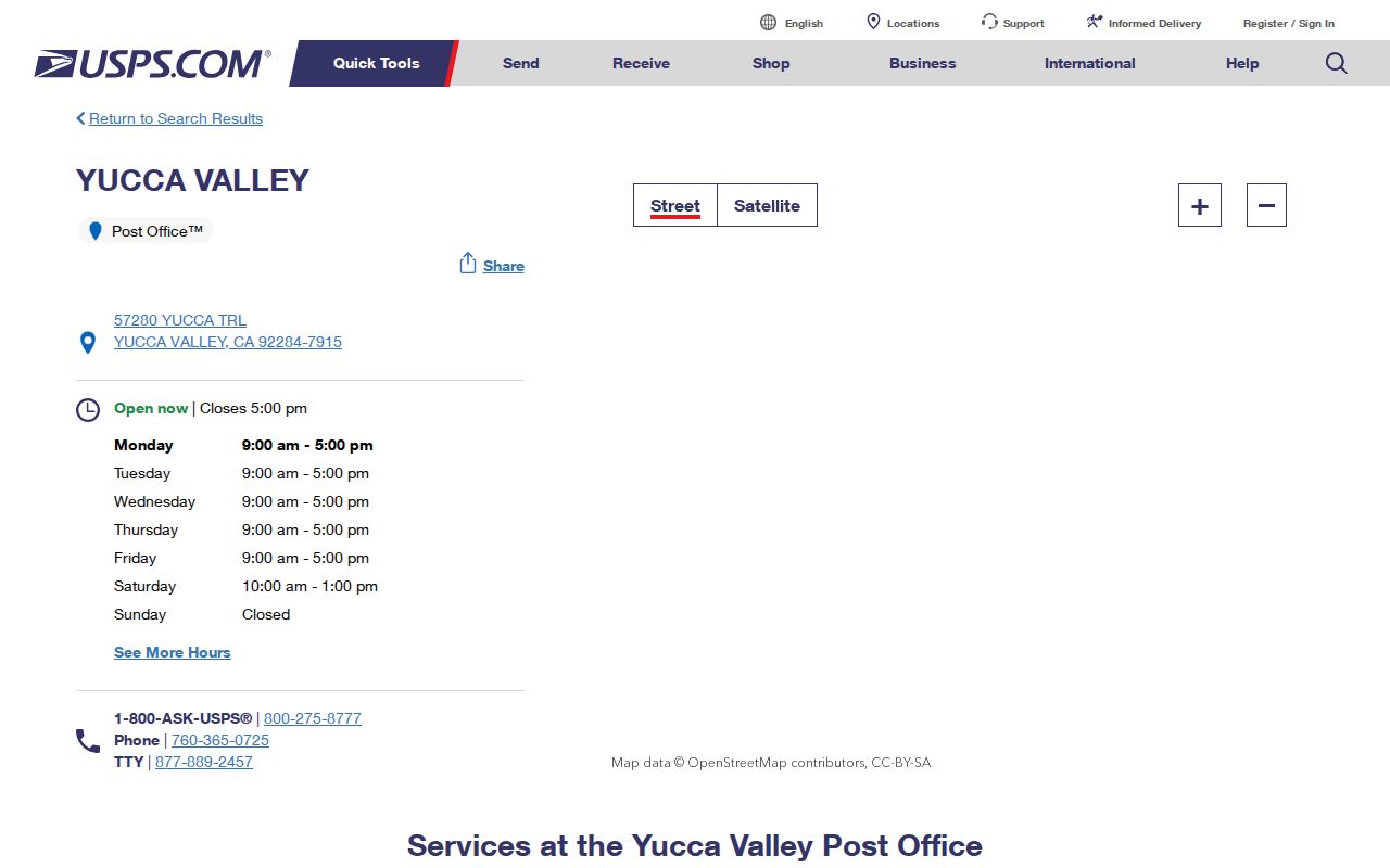
A post office confirms mail service. It does not confirm that a parcel is inside Town limits or that a named person occupies the address.
Yucca Valley 92286 Special Routing
92286 needs a narrow description. Research identifies it as a Yucca Valley postal ZIP used chiefly for PO-box or special postal routing rather than a second ordinary neighborhood geography. The exact box assignment must be checked with USPS. A search result that returns 92286 should therefore be read as a mailing route until a full address, delivery mode, or post office confirmation shows more.
No authoritative record was located for a 92284 or 92286 split or realignment year. That gap matters. A directory should not invent a change date or draw a polygon from a ZIP label. Keep the special-use caveat beside the ZIP, then verify the address through USPS and the parcel through the county map.
PO-box routing also explains why a mailing address and a situs address can diverge. A tax notice, business filing, or court return address may point to a mail route rather than the place where land or a person is located. The ZIP code directory can flag that difference, but only the relevant custodian can resolve it.
USPS ZIP Code Lookup for Yucca Valley
The official USPS lookup has two modes that serve different starting points. Find by Address uses street address, city, and state. Find by City & State uses the city and state when the full delivery point is not yet known. Both modes use a Find button and reset or clear controls. The result standardizes the mailing address and ZIP+4, but USPS warns that an address result does not guarantee the actual physical location of a business.
Use the mode that matches the evidence in hand. A street address should be tested as a full address, including the postal city suggested by the source. A city-only search can reveal the postal choices associated with a place name, but it should not be used to assign a parcel or a resident to Town jurisdiction.
| Find by Address | Street address, city, and state; best for validating a delivery point |
|---|---|
| Find by City & State | City and state; useful when the full street address is not known |
| Find | Submits the selected USPS lookup mode |
| Reset or clear | Removes the prior address or city-state entry |
| Result | Standardized mailing address and ZIP+4, subject to USPS caveats |
Run the USPS ZIP Code Lookup before treating a ZIP code as a search key. The free tool verifies postal geography. It does not return a ZIP-wide list of owners or residents.
Narrowing a Yucca Valley Search by ZIP
A ZIP code directory can narrow a search, but the local portals do not share one ZIP-wide resident mode. Assessor and GIS work is address, APN, map, or parcel first. The recorder index uses party, document, date, and document-number fields, not an address or ZIP search. My Voter Status is an identity match for one voter. Town permits and NextRequest accept an address or APN request, with no verified public ZIP filter.
- Verify the full delivery address with USPS, using Find by Address when a street is known or Find by City & State when only a place name is available.
- Use ARC govPIMS or the public assessor map with a situs address, APN, map, tract, or parcel selection. Do not imply that visually browsing 92284 creates a ZIP-wide owner result.
- Carry the APN or legal description into the recorder index, planning request, permit request, or GIS parcel view. The recorder cannot search its index by street address or ZIP.
- Use My Voter Status only for the voter who can complete identity matching. An approved voter-file request needs a permitted purpose, product, scope, recipients, signature, and payment.
- When a ZIP narrows the area to a road or parcel, continue with the Yucca Valley Streets address workflow rather than treating the ZIP as the final resident list.
This is the key local comparison: USPS can verify a postal label, the assessor can locate a parcel, the recorder can identify indexed parties, and voter access is restricted. No verified public ZIP-wide owner search was found.
Recent changes make the final request step worth checking. ARC's live official-records page posts 2026 mail and copy charges that conflict with older linked PDFs, while the CDPH certificate route stopped accepting applications through online third-party vendors on July 1, 2026. Use the official county or state channel for any address-keyed order.
Yucca Valley APNs Across ZIP Changes
APN and legal description continuity is stronger than a postal label when a parcel crosses a record change. An APN is the assessor's parcel key, normally displayed in grouped digits. Preserve leading zeros and punctuation exactly as the portal returns them. An APN can change after subdivision, combination, or map correction, so save the tract, map, lot, block, or metes-and-bounds description with it.
Situs address, mailing address, and legal description serve different roles. Situs keys assessor, permit, and GIS records. Mailing address routes tax notices or correspondence. Legal description keys title instruments. A deed chain, assessment history, permit request, or planning file should be tied to the legal description when a ZIP or street label changes.
Town Community Development publishes an Address Request and Address Change application. Vacant land needs an address before building-plan submittal, while a developed property can use the application for an address change. No authoritative Town-wide renumbering year or systemic renaming project was located. Ask the planning counter for the assignment letter and any old address or APN cross-reference.
The official Town of Yucca Valley website is the starting point for local department and planning context.
A Town page can identify the local agency, while the parcel key decides which land record should be checked next.
Census ZCTA 92252 and Yucca Valley
Census geography can look like a ZIP code without being a delivery boundary. Census QuickFacts reports that ZCTA 92252 partly overlaps the Town even though Joshua Tree has its own postal identity. A ZCTA is a statistical approximation used for Census reporting. It is not the same thing as USPS delivery territory and it does not decide whether Town, county, or another local agency holds a parcel file.
This distinction matters when a demographic table, map, or data download includes 92252. Treat the number as a Census geography until the USPS address lookup confirms a mailing route. Treat the agency question separately by checking the Town boundary, parcel map, planning office, or court district. Never turn a ZCTA overlap into a claim about an individual or a street.
The Census QuickFacts profile provides statistical context, while the ZIP code directory remains a postal and records-navigation tool.
The Joshua Tree court district is another reminder that records geography follows an agency's service map.
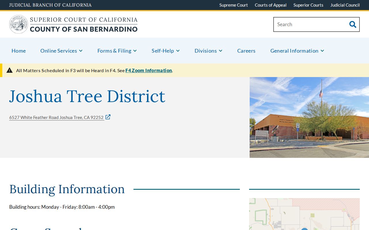
The nearby district serves the Morongo Basin, but a court case can be filed in another San Bernardino County district, so CAP should be searched countywide.
Yucca Mesa ZIP Code, Town Jurisdiction
Yucca Mesa is a local description that can share a Yucca Valley postal identity without proving incorporation inside the Town. A 92284 mailing address may fall outside the Town boundary. Conversely, a parcel near a boundary may be called Yucca Valley in ordinary speech while county Land Use Services or another postal community controls the permit or land-use file.
The correct comparison is postal route versus parcel jurisdiction. Check the Town boundary or GIS parcel, then confirm the planning agency and record custodian. A postal city is useful for finding mail. It is weak evidence for ownership, occupancy, voting geography, permits, or court venue.
Boundary check. A Yucca Valley postal address can sit outside incorporated Town limits. Use the parcel map and planning authority to decide which local record office controls.
Large-lot foothill areas south of Highway 62 contrast with subdivisions and rural edges north and east, while planning material distinguishes Pioneertown Road, Highway 247, Sunnyslope, and nearby tracts. Those are useful local descriptions, not ZIP or neighborhood-directory boundaries.
Yucca Valley Nearby ZIP Identities
92285 belongs to Landers and is served by the Landers Post Office at 890 Landers Lane. 92268 belongs to Pioneertown and is served by the Pioneertown Post Office at 53441 Mane Street. Both communities are close enough to appear in a regional search, but neither is automatically a Yucca Valley Town ZIP. Their separate postal identities should remain visible in a ZIP code directory.
92252 is tied to Joshua Tree for postal purposes, even though its Census ZCTA partly overlaps Town geography. 92286 is tied to Yucca Valley routing but is treated as special or PO-box use unless USPS confirms a street delivery. These contrasts are more useful than a made-up boundary line because each source can be checked against a real address.
When a search begins with a person rather than an address, do not infer the person's location from a nearby ZIP. Search an official record, preserve the exact city and ZIP returned, and note whether the field is a mailing, situs, practice, or historical reported address.
ZIP Code Definitions for Yucca Valley Searches
Short postal terms prevent a clean-looking result from carrying more meaning than the source supports. The distinctions below belong in a ZIP code directory because they explain why a USPS result, Census map, assessor parcel, and Town file may disagree without any one source being wrong.
- ZIP code
- A USPS delivery-routing label tied to an address or postal destination; it is not a Town boundary.
- ZIP+4
- The added four digits that refine a delivery route or box grouping after the five-digit ZIP.
- PO-box ZIP
- A ZIP used chiefly for post-office boxes or special routing rather than ordinary street delivery.
- Unique ZIP
- A postal code assigned to a single institution or narrow destination, not a normal neighborhood area.
- Carrier route
- A delivery path inside a postal operation; it is finer than a ZIP and not a resident roll.
- ZCTA
- A Census statistical approximation that may overlap a ZIP-like label without matching USPS delivery geography.
For Yucca Valley, the safe sequence is USPS verification, parcel or APN confirmation, then the custodian for the record type. That sequence preserves the difference between a mailing label, a statistical area, a Town jurisdiction, and a person or property record.