
Trace a Yucca Valley Address
A street-by-street search works best when the address becomes a stable parcel key. Start with ARC govPIMS or the public assessor map. Record the APN, situs address, legal description, map or tract reference, and any displayed transfer or parcel-history detail. Then inspect the surrounding map, carry the APN into the recorder index, and request Town files by address and APN. The result is an evidence trail rather than a guess based on a street name.
The chain separates ownership clues from household clues. ARC property information describes a parcel. The recorder names grantors and grantees in a recorded instrument. Planning and permit files name applicants, owners, agents, contractors, or inspectors. A voter-file request has a different legal gate, and a reverse directory may show only a listed subscriber.
- Run the known address or APN through ARC Parcel Access and save the displayed parcel key.
- Browse the same street in the Public Assessor Map, clicking adjacent polygons one at a time.
- Use the APN, legal description, and transfer date to narrow the recorder's grantor and grantee search.
- Ask Town planning or the permit repository for address, application, inspection, and entitlement records.
- Use a verified reverse directory or census enumeration route for an older household, then compare dates.
Street-Level Yucca Valley Records by Address
The Yucca Valley street directory is assembled from record sets with different custodians. The APN links parcel facts to maps and tax history. The deed index uses party names and dates, not a street search. Town planning files are address keyed but an applicant may not be a resident. Voter data can contain residence information for permitted recipients, yet it is not an open street roll. Historical directories show only the people included in a particular edition.
| Record set | Keeper | Street clue | Access |
|---|---|---|---|
| Parcel and assessment | ARC Assessor | APN, situs, characteristics, values, parcel history | Free map and property search; name limits |
| GIS parcel view | San Bernardino County ARC | Adjacent polygons, map context, APNs | Free interactive viewer |
| Recorded instruments | ARC Recorder | Grantor, grantee, title, recording date | 1925-present index; images by counter or order |
| Planning and permits | Town Community Development | Applications, project, address, APN, inspections | Counter, repository, or focused request |
| Reverse directory | Library or historical society | Listed subscriber by house number and street | Verify local volume and year |
| Voter file | Registrar of Voters | Residence and precinct for approved purpose | Not general public street browsing |
A street record answers a narrower question than a residents list. Join records with APN, legal description, date, and role. Keep the situs address separate from the mailing address. A parcel may have a mailing destination for an owner, trust, agent, or bill recipient that is not the physical property.
ARC govPIMS for a Yucca Valley Street
ARC's govPIMS and Public Assessor Map provide the main modern address route. The county manual documents several search modes, while current public display can remove some owner and mailing fields under Government Code Section 7928.205. A name mode may offer Active Names, Inactive Names, Formatted Name, and Unformatted Name. Those modes are useful for parcel research, but they do not turn the map into a universal Yucca Valley street directory.
| Field or control | Type | Street research use |
|---|---|---|
| Parcel Number | Text search | Stable APN key for a known parcel |
| Situs Address | Address fields | Find the physical location by house number and street |
| Owner Name | Active or inactive name mode | Test an available owner association, subject to disclosure limits |
| Assessor Map or Parcel Map | Map reference | Move from street view to lot, block, and recorded map context |
| Tract Map | Subdivision reference | Hold a parcel identity across address questions |
| Attached Parcel or Property ID | Text search | Follow related or internal county identifiers |
The result modules can include parcel information, ownership information, parcel history, roll-value history, supplement history, land characteristics, residence characteristics, other improvements, an official parcel map, an interactive map, and a parcel report. Values are assessment facts, not a sale-price record or title opinion. Preserve the exact APN formatting returned by the portal.
The ARC property-information page is the source entry point for the map and Parcel Access tools.
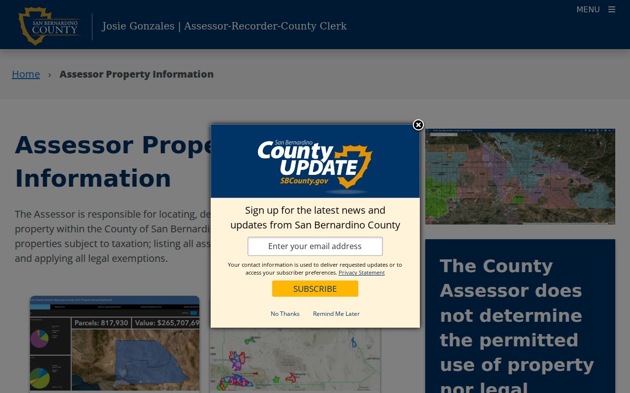
The county property page shows why the APN is the bridge between a street view and later deed research.
Yucca Valley Street Parcels in the Map
The Public Assessor Map supports a visual walk along a Yucca Valley street. Use an address or APN to locate the target, select the parcel polygon, and note the APN and map context. Then clear the selection before clicking the next shared-boundary or across-street polygon. The map can reveal vacant lots, corner parcels, subdivisions, and the shape of a block, but it does not reveal every person associated with a structure.
ARC maintains more than 23,000 continuously updated parcel maps. Basemap, aerial, layer, legend, identify, zoom, measure, print, and share controls can vary. Parcel geometry is the defensible answer to which lots touch. Zoning, permitted use, flood status, and Town land-use decisions require the responsible planning or safety agency, not an inference from a map layer.
- Parcel
- A county land unit identified by an APN.
- Situs address
- The physical location attached to the parcel record.
- Plat or parcel map
- A recorded map that helps hold lot and subdivision identity.
- APN
- The assessor's parcel number used to join map, tax, and property records.
The GIS view is therefore a geography tool. It helps the Yucca Valley street directory move from one known address to nearby parcels without claiming a complete household list.
Yucca Valley Street Owner and Situs
Situs and mailing fields describe different places. Situs is where the taxed parcel sits. Mailing address is where tax correspondence goes. When they match, the combination may support an owner-connection hypothesis alongside other evidence. When they differ, the mailing destination may belong to an owner, trust, agent, post office box, or preferred correspondence route. Neither field identifies every person at the parcel.
Assessment data can include land and improvement characteristics, assessed value, roll history, supplemental history, parcel maps, and transfer dates. The Assessor warns that its information does not decide permitted use or legal ownership. A homeowner exemption can support an owner-occupancy clue for a qualifying tax year, while its absence proves little. The tax collector's bill or payment status is also tied to a parcel or bill, not a household.
Carry an APN Through Yucca Valley Deeds
The recorder's Official Records index does not search by street address. Start with the parcel and use the available owner or transfer clue to reach the party index. A result gives document number, recording date, title, grantor, and grantee. Search spelling variants, initials, name order, company names, trusts, spouses, estate representatives, and the seller side of each transfer.
A deed chain is an ownership trail, not automatically a resident trail. The current grantee may be an individual, trust, company, or estate. The document may include a legal description, APN when supplied, consideration or tax declarations, return address, signatures, and acknowledgment. Images are not ordinarily viewable remotely; inspect them at the Hall of Records or High Desert Government Center, or order a copy.
- Locate the present APN and displayed transfer date in Parcel Access.
- Search the likely grantee in the recorder index around that date.
- Match the deed's legal description or APN, not just a similar name.
- Search the deed's grantor as an earlier grantee and repeat backward.
- At the 1925 online cutoff, ask ARC Historical Archives or a cataloged county series for earlier books.
The ARC grantor and grantee search explains the index entry point and spelling-variation advice.
The index screen is most useful after the map has supplied a strong party, date, or legal-description clue.
Town Permits Along a Yucca Valley Street
Town planning and permit files add a project timeline to the Yucca Valley street directory. The Town lists site-plan review, conditional-use, land-use compliance review, variance, tentative parcel or tract maps, lot-line adjustment or merger, signs, temporary uses, and address assignment or change applications. These records may name an applicant, owner, authorized agent, contractor, or project contact. The named party is not proof of residence.
A Town email in the research advises asking for the cited Land Use Compliance Review plus any other building permits or entitlements for the property. That wording can produce a fuller address file. If a public permit lookup is absent, request permits, applications, inspection cards, certificates of occupancy, disclosable plans, code cases, and address-assignment records by street and APN. Copyright or security rules can limit plans, and residential plans may be retained for no more than six months after completion.
The Town permit repository is browsed alphabetically by street in the captured source.
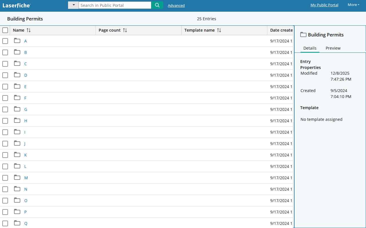
An alphabetical permit file can date a change to a parcel without claiming who lived there during the work.
Reverse Directory for Older Yucca Valley Streets
For older addresses, the Yucca Valley street directory may be a telephone or criss-cross source rather than a modern digital directory. The verified Library of Congress reel is cataloged under Banning, covers December 1950 through January 1959, and files a 1950 Yucca Valley page under the Joshua Tree exchange. A reverse section can move from street and house number to listed subscriber. The exact local volume runs at the branch and historical society still need confirmation.
Keep printed spelling. The inspected sample includes the form Yucca Vally, and exchange or nearby-community labels can hide a search hit. A telephone directory is not a Polk directory. It may show subscriber, number, street, rural route, or a business, but it does not reliably show every household member, spouse, or non-subscribing person. Compare a directory page with census enumeration, newspaper notices, permits, or deeds.
The full historical shelf and collection caveats belong on the Yucca Valley City Directory page. A street search should borrow the reverse-address method without rebuilding that collection history.
ZIP Geography on a Yucca Valley Street
Postal city and Town jurisdiction do not always align. ZIP 92284 is the primary Yucca Valley delivery ZIP and extends beyond the incorporated line, including places described locally as Yucca Mesa or nearby desert areas. ZIP 92286 is associated with Yucca Valley postal and PO-box routing, but the exact box assignment must be checked with USPS. Joshua Tree ZIP 92252 has a Census ZCTA that partly overlaps the Town without becoming a USPS or municipal boundary.
Use USPS to verify a complete mailing address, then use parcel boundaries and Town or county planning jurisdiction to identify the responsible office. ZIP 92285 is Landers and ZIP 92268 is Pioneertown. A postal match can help route a request, but it cannot prove that a parcel sits inside Yucca Valley or that a person is connected to the street.
Definitions for a Yucca Valley Street Search
Address research fails when a term is treated as proof of something broader. These plain meanings keep the street directory focused on what each record can actually support.
- Grantor
- The party transferring an interest in a recorded instrument.
- Grantee
- The party receiving an interest in that instrument.
- Legal description
- The formal land description used to identify the parcel in a title record.
- Criss-cross directory
- A reverse directory arranged by street and number rather than only by surname.
- Occupant
- A person associated with an address in a source, not proof of ownership or a complete household.
Keep the source date beside each term. A 1950 subscriber entry, a 1978 assessment value, a 1990 water record, and a current parcel map describe different moments.
Limits of a Yucca Valley Street Directory
No public source supplies a complete list of everyone at every Yucca Valley address. The voter file is restricted to approved users and purposes. DMV address data is protected by the federal Driver's Privacy Protection Act. Utility customer accounts, delivery records, and private association rosters are not open street-directory sources. Household members, unlisted subscribers, and people using a protected address may never appear.
Planning applicants, tax-mail recipients, and deed parties also require careful reading. Each can be connected to a parcel or project without being the person who lives there. If the question shifts from a whole street to one individual, use the Yucca Valley resident lookup workflow and keep the same-name safeguards in place.